Comentariul autorului:
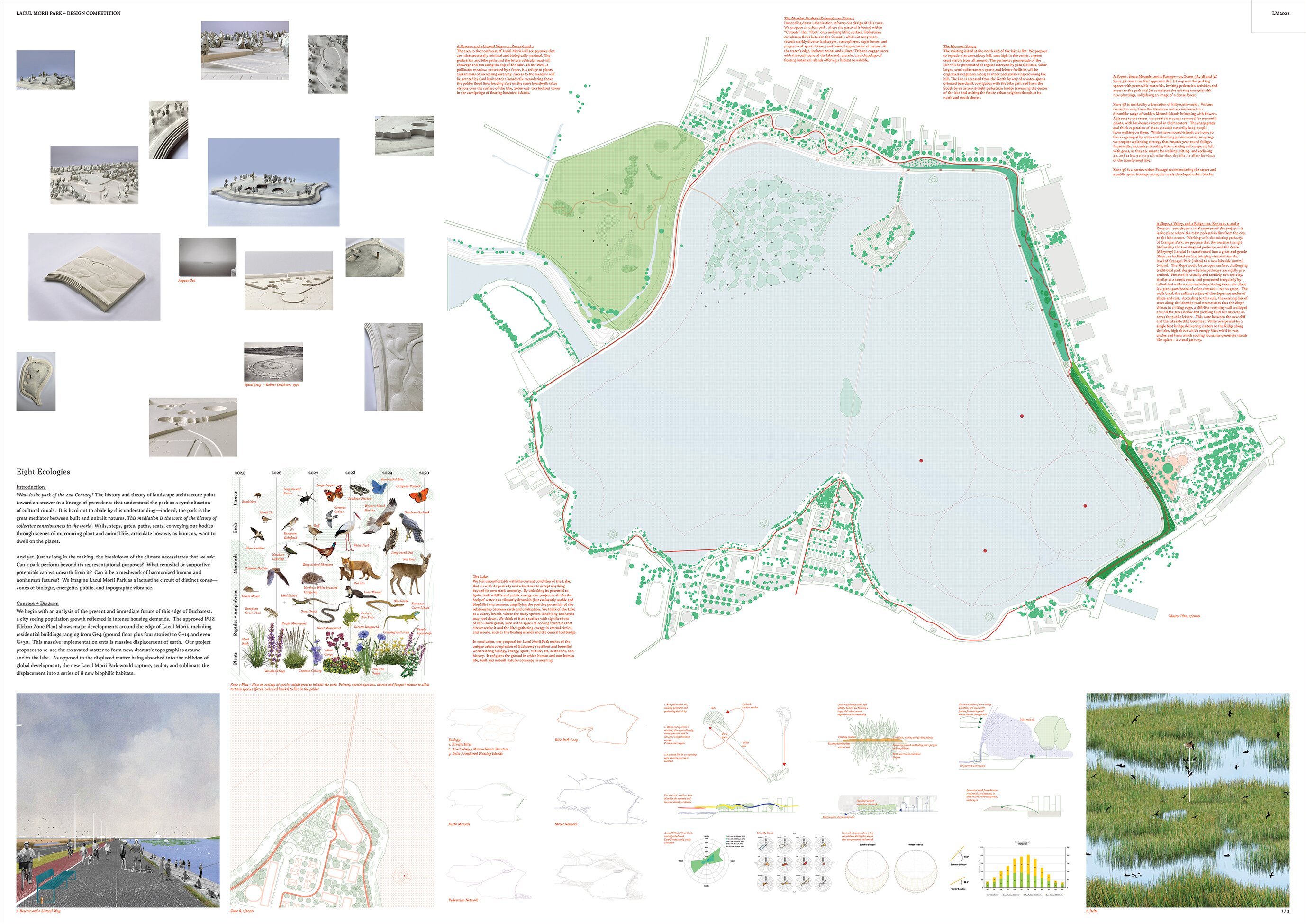
Eight Ecologies
Introduction
What is the park of the 21st Century? The history and theory of landscape architecture point toward an answer in a lineage of precedents that understand the park as a symbolization of cultural rituals. It is hard not to abide by this understanding—indeed, the park is the great mediator between built and unbuilt natures. This mediation is the work of the history of collective consciousness in the world. Walls, steps, gates, paths, seats, conveying our bodies through scenes of murmuring plant and animal life, articulate how we, as humans, want to dwell on the planet.
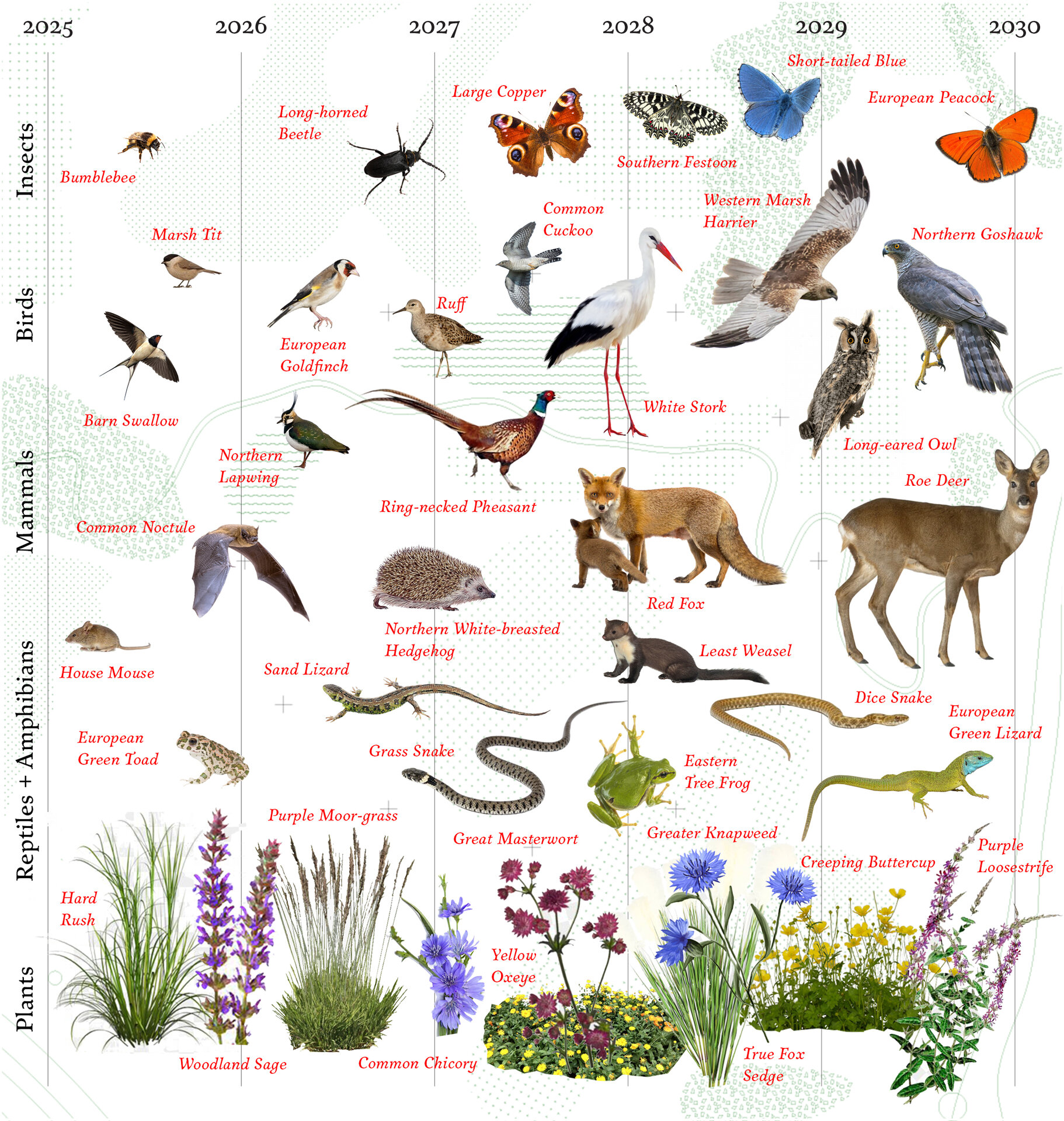
And yet, just as long in the making, the breakdown of the climate necessitates that we ask: Can a park perform beyond its representational purposes? What remedial or supportive potentials can we unearth from it? Can it be a meshwork of harmonized human and nonhuman futures? We imagine Lacul Morii Park as a lacrustine circuit of distinct zones—zones of biologic, energetic, public, and topographic vibrance.
Concept & Diagram
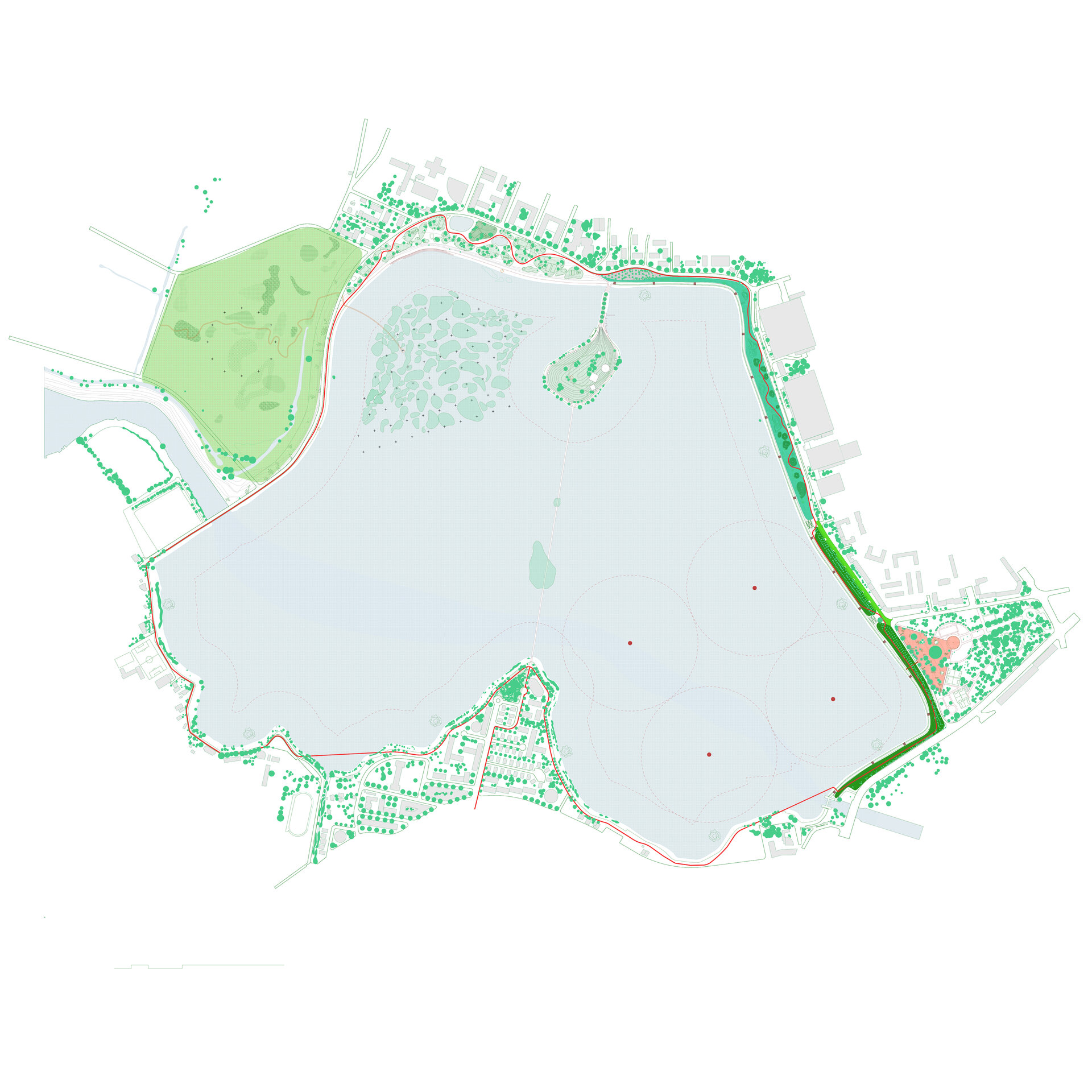
We begin with an analysis of the present and immediate future of this edge of Bucharest, a city seeing population growth reflected in intense housing demands. The approved PUZ (Urban Zone Plan) shows major developments around the edge of Lacul Morii, including residential buildings ranging from G+4 (ground floor plus four stories) to G+14 and even G+30. This massive implementation entails massive displacement of earth. Our project proposes to re-use the excavated matter to form new, dramatic topographies around and in the lake. As opposed to the displaced matter being absorbed into the oblivion of global development, the new Lacul Morii Park would capture, sculpt, and sublimate the displacement into a series of 8 new biophilic habitats.
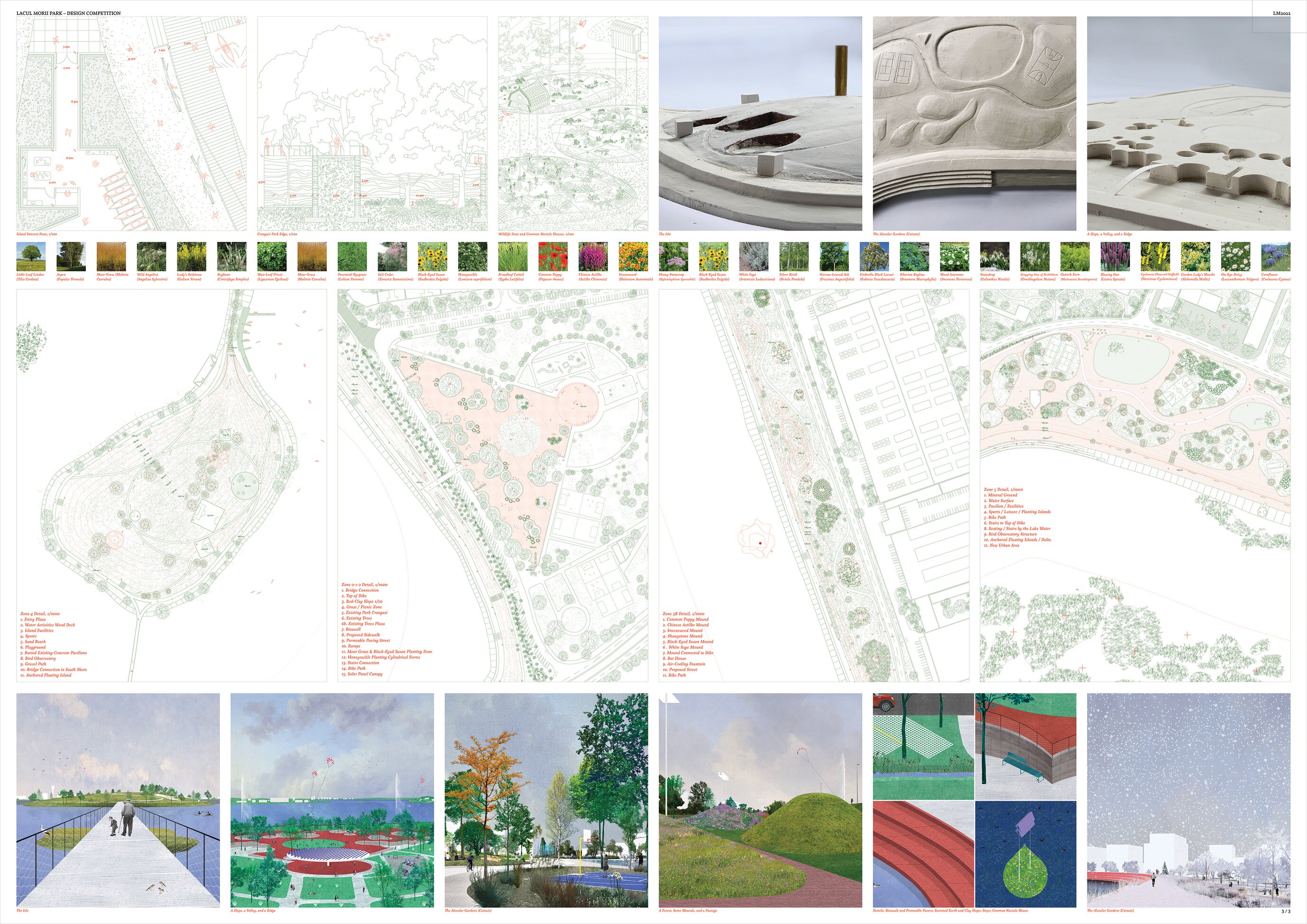
A Slope, a Valley, a Ridge (Zones 0, 1, and 2)
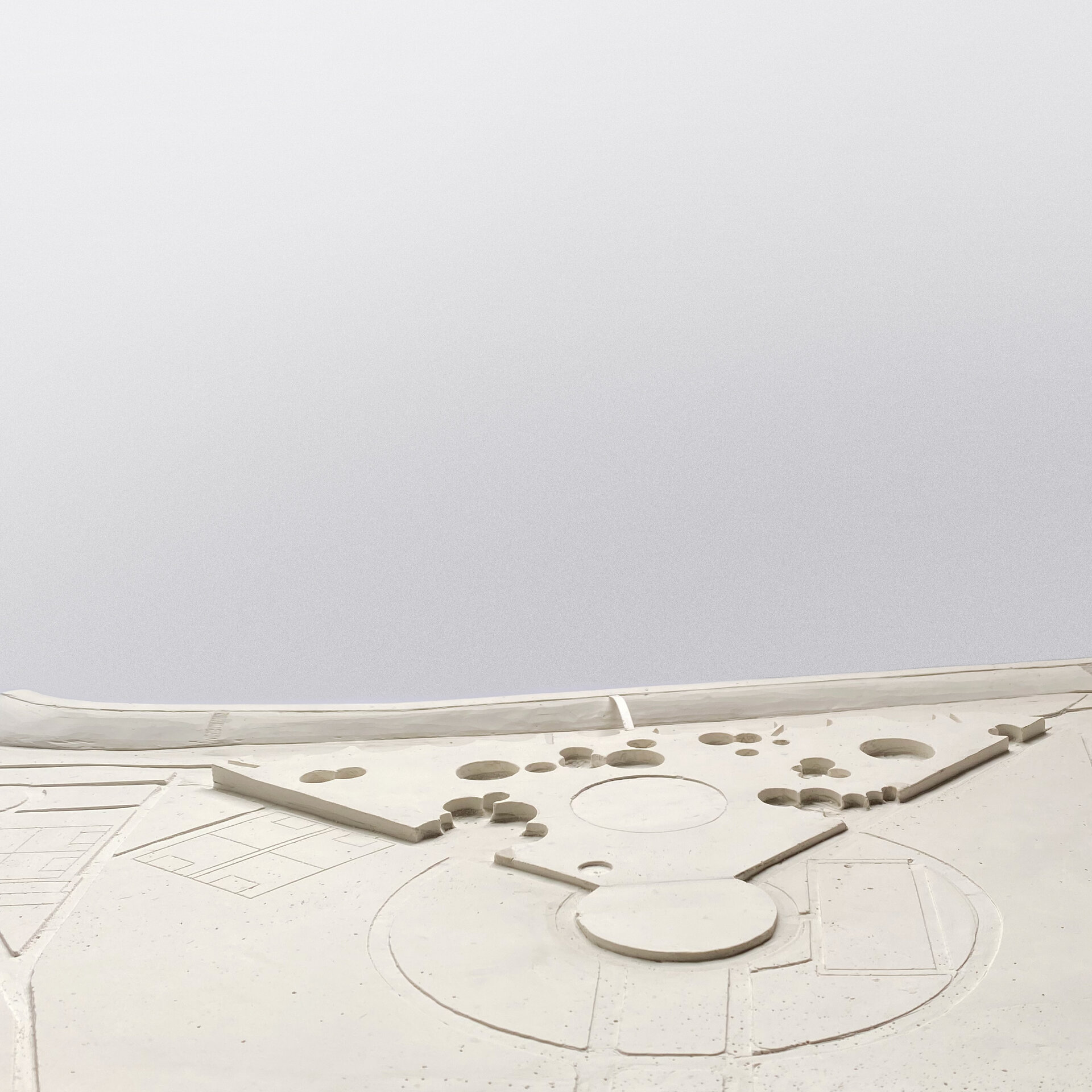
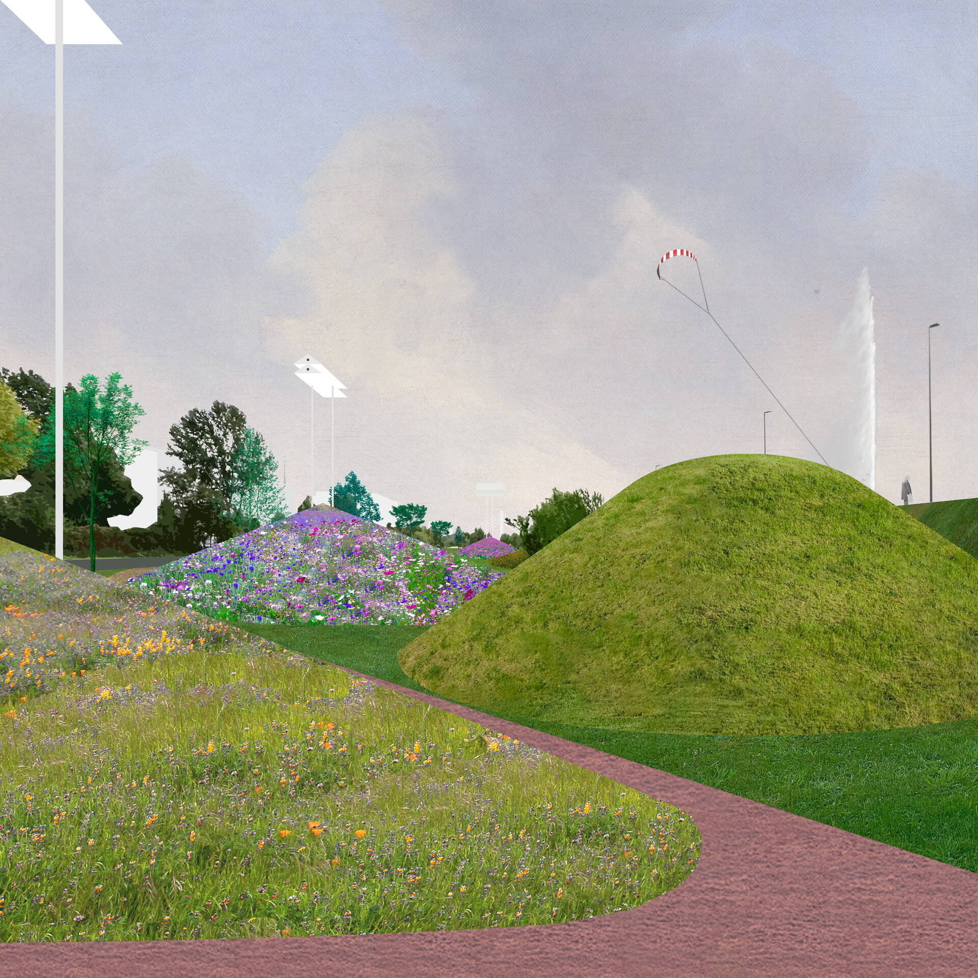
Zone 0-2 constitutes a vital segment of the project—it is the place where the main pedestrian flux from the city to the lake occurs. Working with the existing pathways of Crangasi Park, we propose that the western triangle (defined by the two diagonal pathways and the Aleea (Alleyway) Lacului be transformed into a great and gentle Slope, an inclined surface bringing visitors from the level of Crangasi Park (+82m) to a new lakeside summit (+87m). The Slope would be an open surface, challenging traditional park design wherein pathways are rigidly prescribed. Finished in visually and tactilely rich red-clay, similar to a tennis court, and punctured irregularly by cylindrical wells accommodating existing trees, the Slope is a giant gameboard of color contrast—red vs green. The wells break the radiant surface of the slope into nodes of shade and rest. According to this rule, the existing line of trees along the lakeside road necessitates that the Slope climax in a lilting edge, a cliff-like retaining wall scalloped around the trees below and yielding fluid but discrete alcoves for public leisure. This zone between the new cliff and the lakeside dike becomes a Valley overpassed by a single foot bridge delivering visitors to the Ridge along the lake, high above which energy kites whirl in vast circles and from which cooling fountains penetrate the air like spires—a visual gateway.
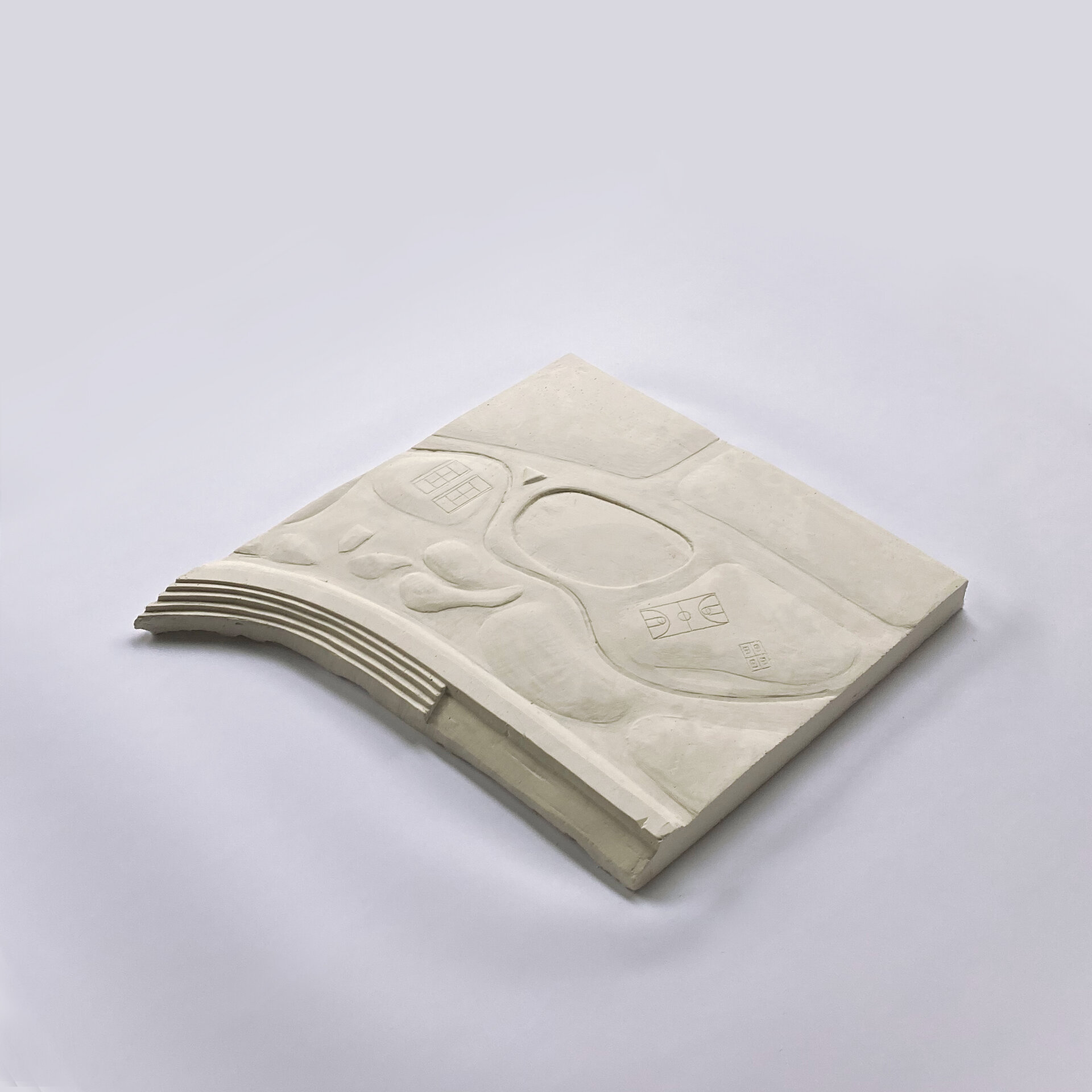
a Forest, Some Mounds, a Passage (Zones 3 A, B, C)
.
Zone 3A sees a twofold approach that (1) re-paves the parking spaces with permeable materials, inviting pedestrian activities and access to the park and (2) completes the existing tree grid with new plantings, solidifying an image of a dense forest.
Zone 3B is marked by a formation of hilly earth works. Visitors transition away from the lakeshore and are immersed in a dreamlike range of sudden Mound-islands brimming with flowers. Adjacent to the street, we position mounds reserved for perennial plants, with bat-houses erected in their centers. The sharp grade and thick vegetation of these mounds naturally keep people from walking on them. While these mound-islands are home to flowers grouped by color and blooming predominately in spring, we propose a planting strategy that ensures year-round foliage. Meanwhile, mounds protruding from existing soft-scape are left with grass, as they are meant for walking, sitting, and reclining on, and at key points peak taller than the dike, to allow for views of the transformed lake.
Zone 3C is a narrow urban Passage accommodating the street and a public space frontage along the newly developed urban blocks.
The Isle (Zone 4)
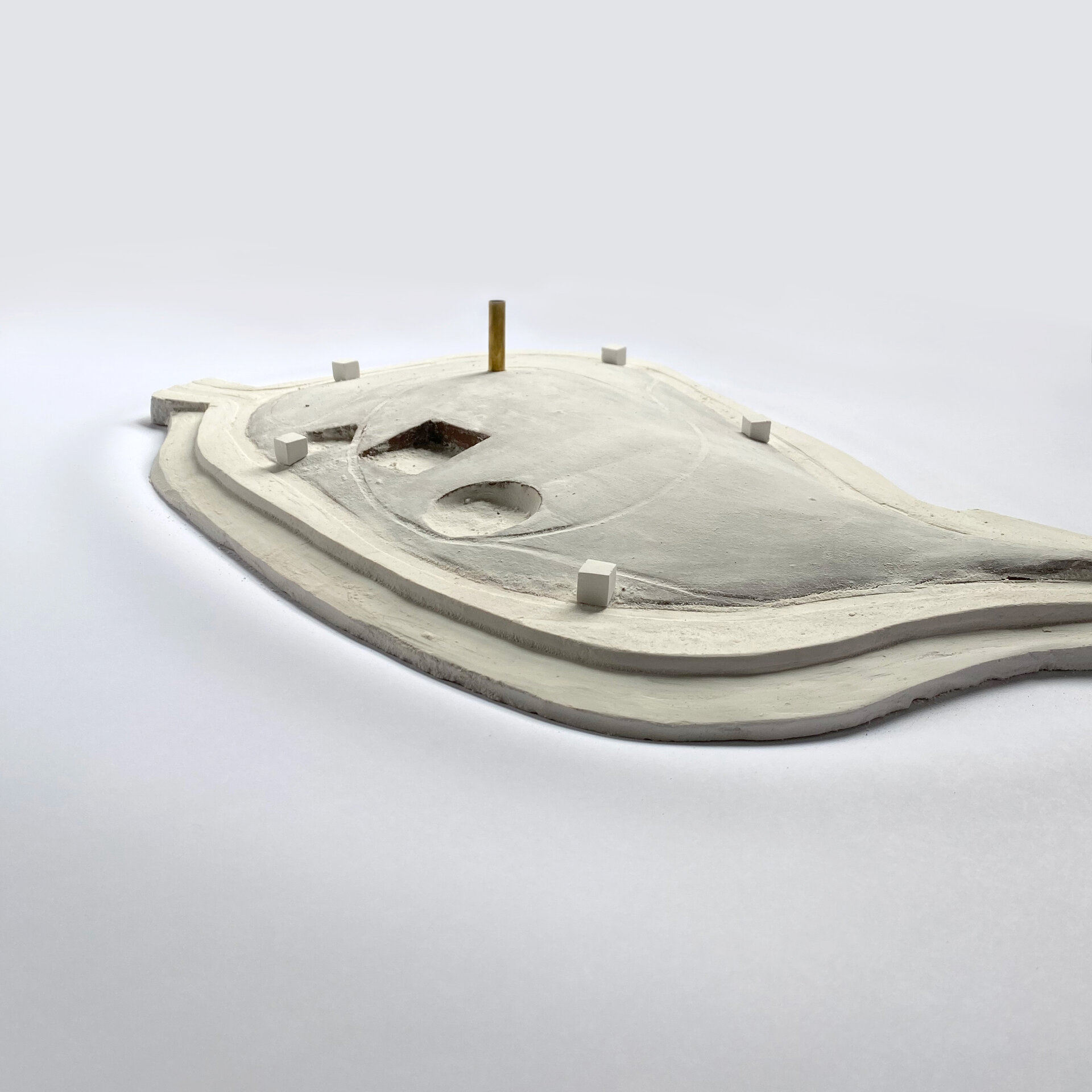
The existing island at the north end of the lake is flat. We propose to regrade it as a meadowy hill, 10m high in the center, a green crest visible from all around. The perimeter promenade of the Isle will be punctuated at regular intervals by park facilities, while larger, semi-subterranean sports and leisure facilities will be organized irregularly along an inner pedestrian ring crowning the hill. The Isle is accessed from the North by way of a water-sports-oriented boardwalk contiguous with the bike path and from the South by an arrow-straight pedestrian bridge traversing the center of the lake and uniting the future urban neighborhoods at its north and south shores.
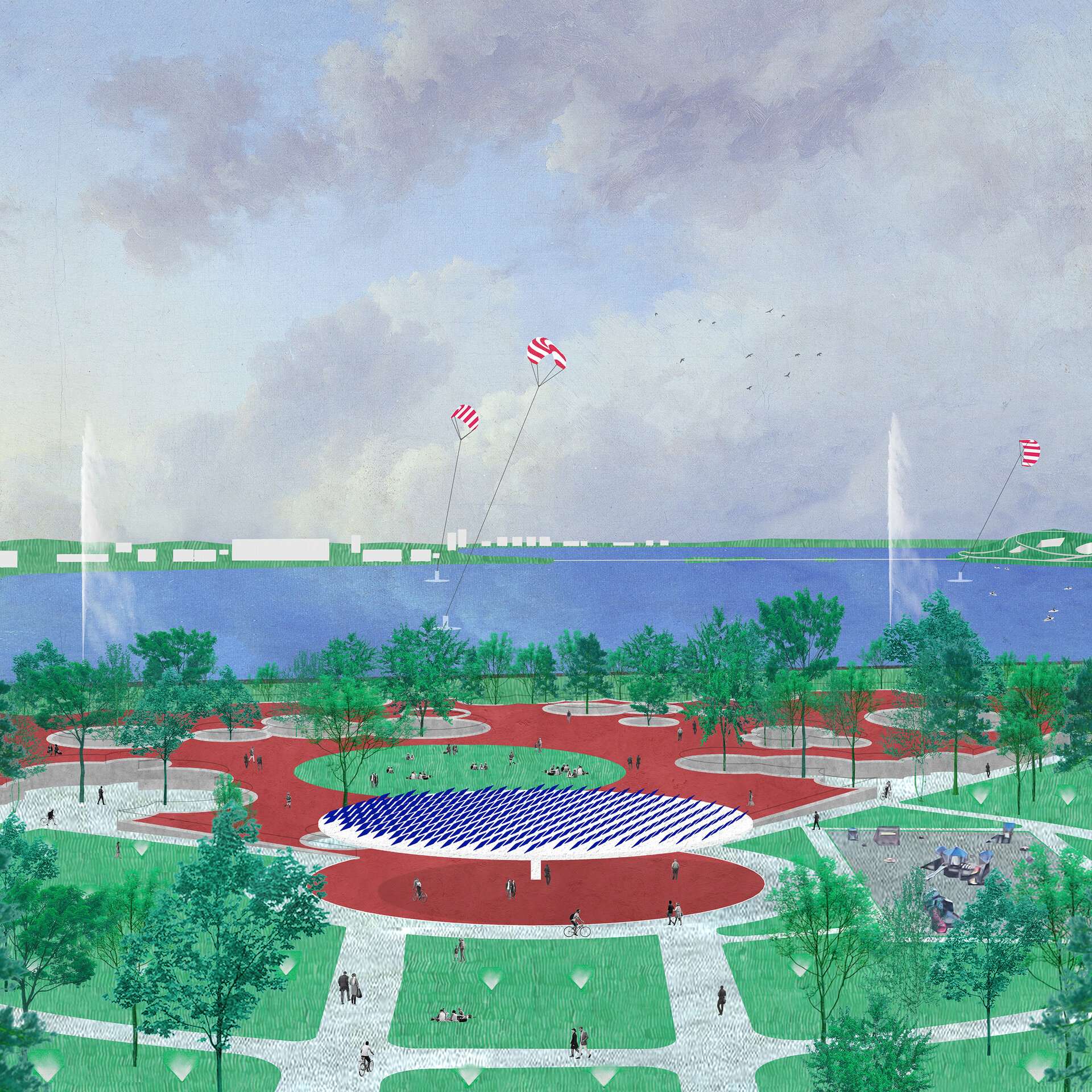
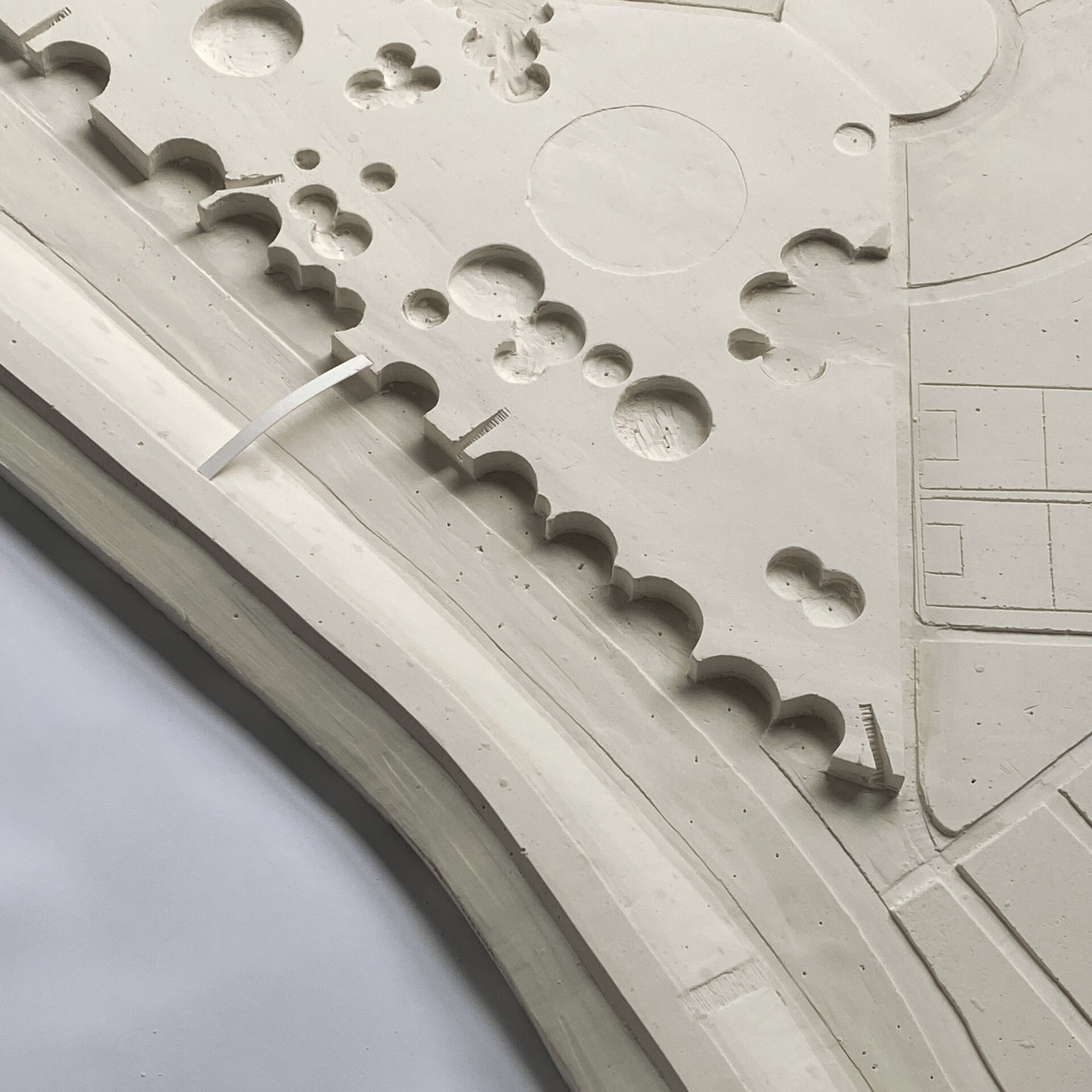
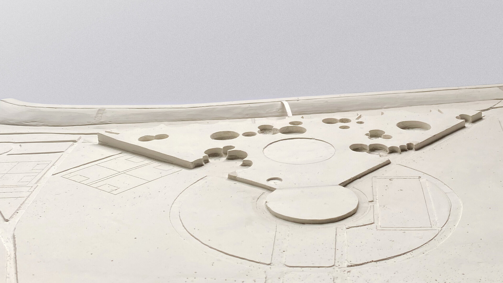
The Alveolar Gardens—Cutouts (Zone 5)
Impending dense urbanization informs our design of this zone. We propose an urban park, where the pastoral is bound within “Cutouts” that “float” on a unifying lithic surface. Pedestrian circulation flows between the Cutouts, while entering them reveals starkly diverse landscapes, atmospheres, experiences, and programs of sport, leisure, and framed appreciation of nature. . At the water’s edge, lookout points and a linear Tribune engage users with the total scene of the lake and, therein, an archipelago of floating botanical islands offering a habitat to wildlife.
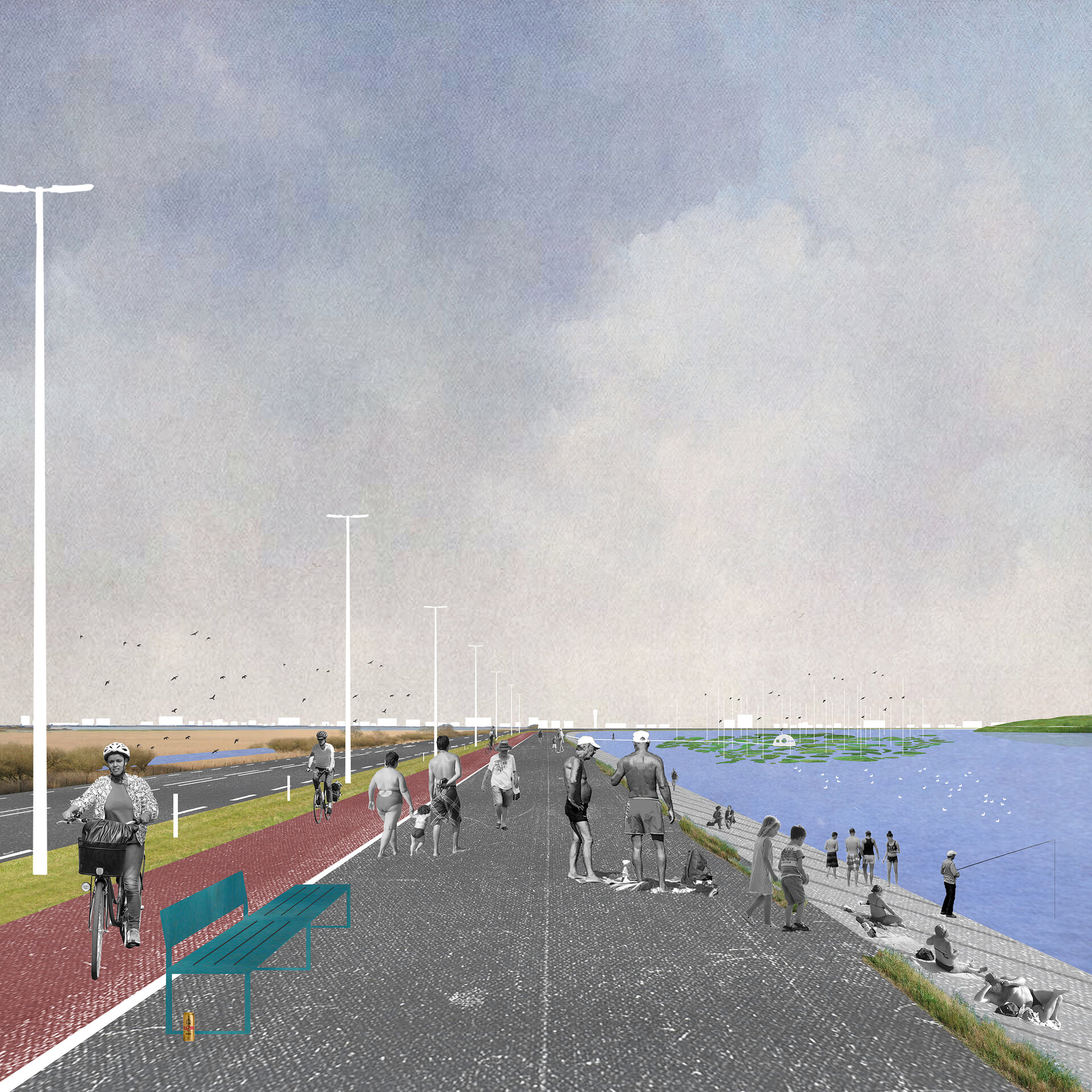
A Reserve, a Littoral Way (Zones 6 and 7)
The area to the northwest of Lacul Morii will see gestures that are infrastructurally minimal and biologically maximal. The pedestrian and bike paths and the future vehicular road will converge and run along the top of the dike. To the West, a pollinator meadow, protected by a fence, is a refuge to plants and animals of increasing diversity. Access to the meadow will be granted by (and limited to) a boardwalk meandering above the polder flood line; heading East on the same boardwalk takes visitors over the surface of the lake, 200m out, to a lookout tower in the archipelago of floating botanical islands.
The Lake
We feel uncomfortable with the current condition of the Lake, that is: with its passivity and reluctance to accept anything beyond its own stark enormity. By unlocking its potential to ignite both wildlife and public energy, our project re-thinks the body of water as a vibrantly dreamish (but eminently usable and biophilic) environment amplifying the positive potentials of the relationship between earth and civilization. We think of the Lake as a watery hearth, where the many species inhabiting Bucharest may cool down. We think of it as a surface with significations of life—both grand, such as the spires of cooling fountains that circumscribe it and the kites gathering energy in eternal circles, and serene, such as the floating islands and the central footbridge.
In conclusion, our proposal for Lacul Morii Park makes the unique urban complexion of Bucharest a resilient and beautiful work relating biology, energy, sport, culture, art, aesthetics, and history. It refigures the ground in which human and non-human life, built and unbuilt natures converge in meaning.